


Standard Navigation, 64 Cape Cod and Harbors

 4.3 (112 items)
 Limited Time Sale
$23.39 cheaper than the new price!!
Free cash-on-delivery fees for purchases over $99
Product details
| Management number | 214525510 | Release Date | 2026/04/12 | List Price | $15.60 | Model Number | 214525510 | ||
|---|---|---|---|---|---|---|---|---|---|
| Category | |||||||||
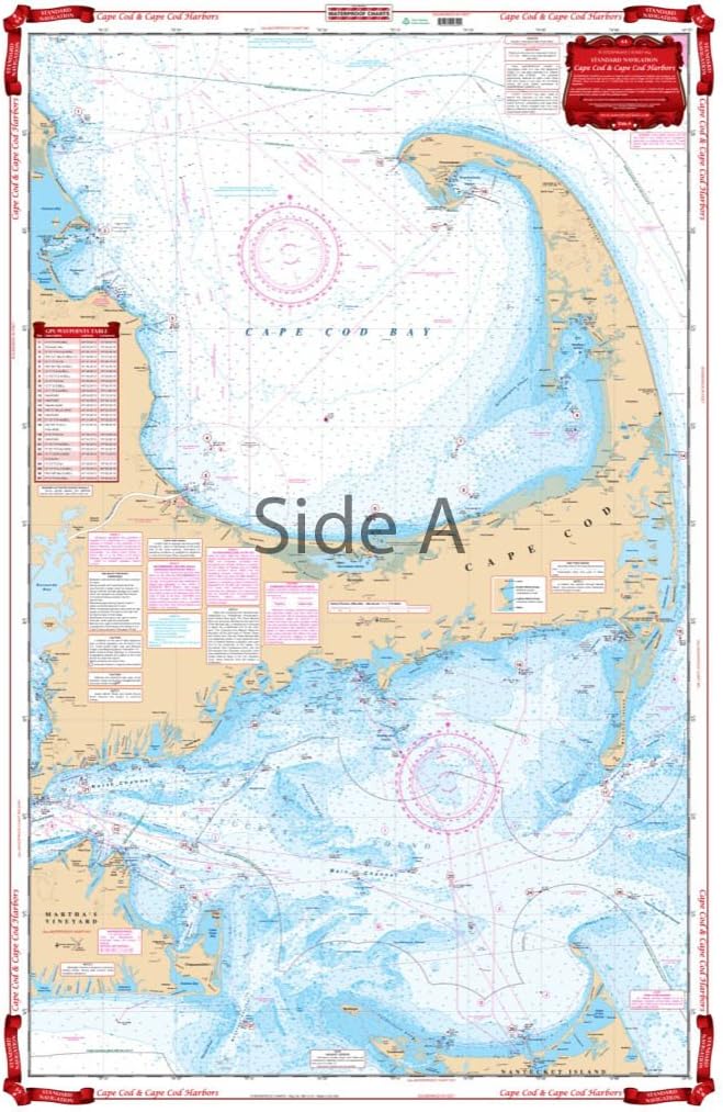
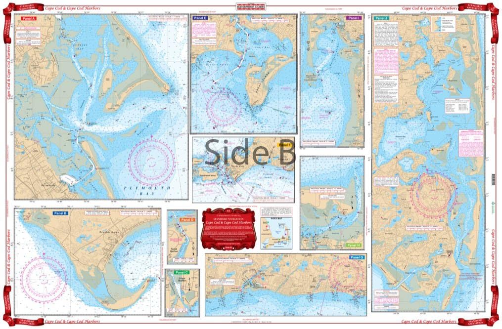
A creative combination of government charts allows coverage of all of Cape Cod on a single side, from Provincetown south to Nantucket and west to Falmouth. Large print place names make areas and towns very easy to find. GPS Waypoints are printed directly on the chart. The reverse side has 10 enlarged blow ups for the following habors: Chatham and Pleasant Bay, South Yarmouth, West Dennis and Harwich Port, Barnstable, Wellfleet, Woods Hole and Falmouth, Hyannis, Plymouth and Provincetown. An excellent color key makes these insets easy to find. Information from 8 different NOAA Charts: #13246, #13237, #13248, #13229, #13250, #13249, #13251, and #13253. Chart is 25" X 38". WGS84 - World Mercator Datum.
- Two Sided
- Foldable
- Tear Resistant Synthetic Paper (Hop-Syn) 5 PP Tree Friendly
| Material | Polypropylene |
|---|---|
| Brand Name | Waterproof Charts |
| Part Number | 64 |
| Manufacturer | Waterproof Charts |
Bestseller ranking
Goldenseal


Customers who viewed this product also viewed
Charts & Maps


Correction of product information
If you notice any omissions or errors in the product information on this page, please use the correction request form below.
Correction Request Form